Feel the
country.
The terrain is physically raised. Postcards you can feel, for all 50 states and the USA.

1,900+ people are on our launch list. Prefer email updates?
- 51planned cards
- 4 × 6 inpostcard format
- Live nowEnds October 22, 10:00 AM ET

Feel the terrain
Most maps you look at. Far Maps you feel.
The image is printed. The terrain is physically embossed. Raking light reveals the same ridges and valleys your fingertips meet.
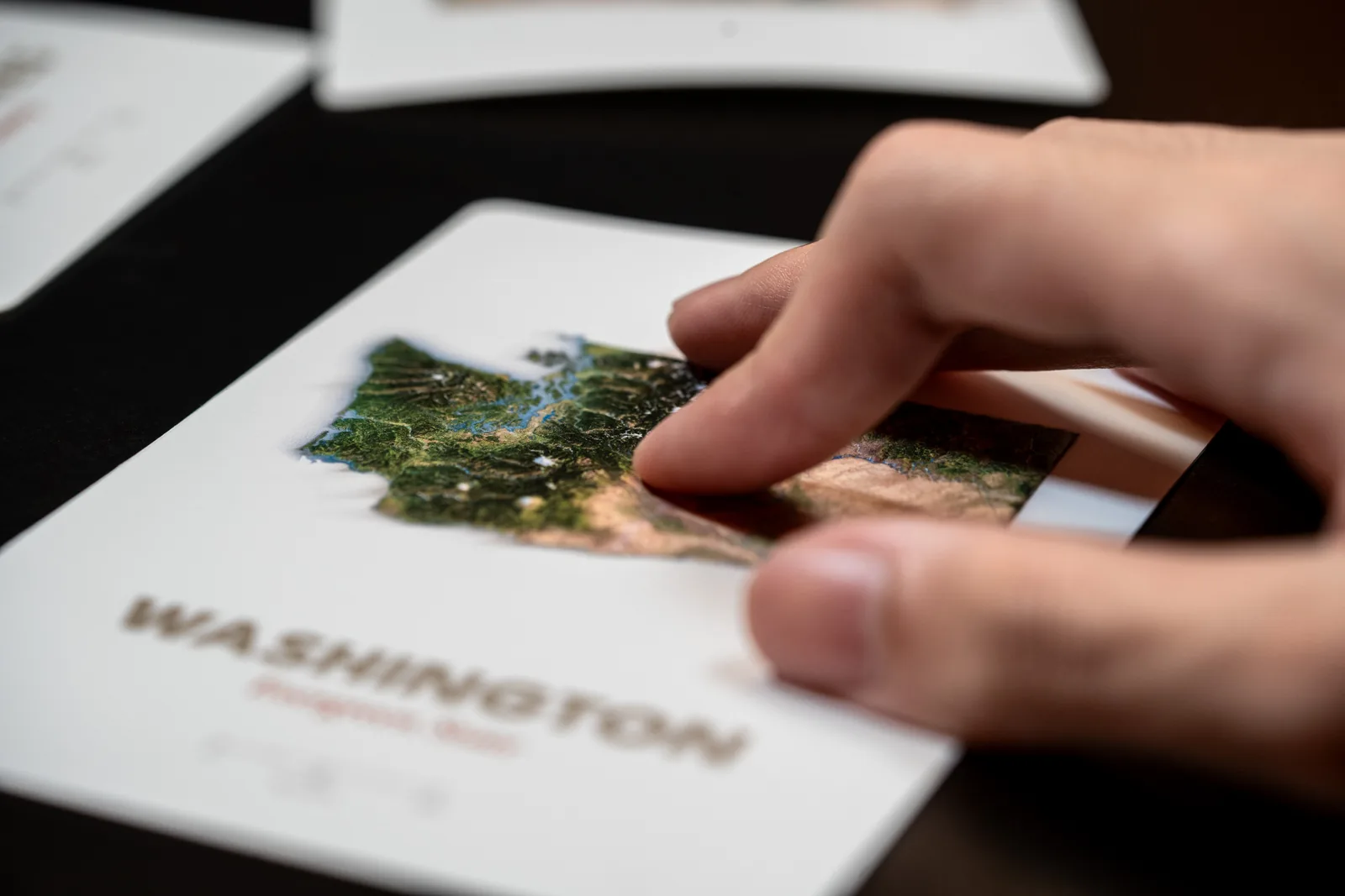


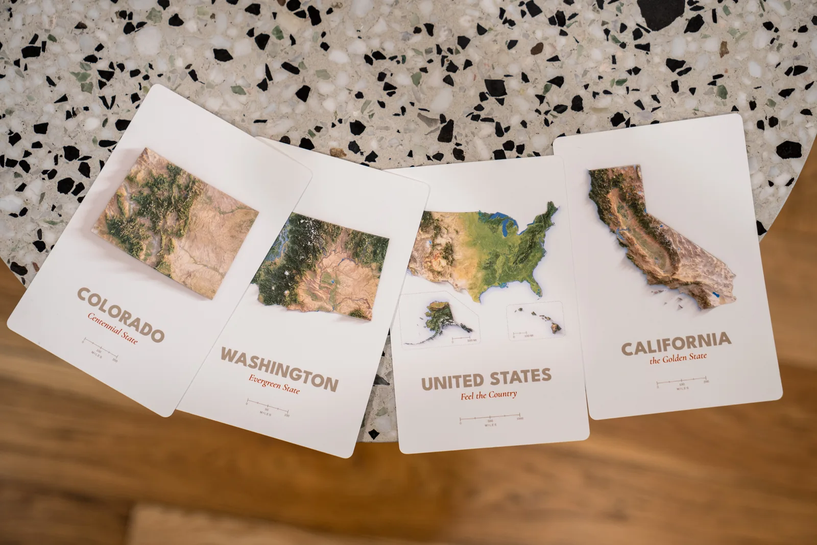
Production proofs
All 50 states and the USA. These are the first four.
California, Washington, Colorado, and USA are the current physical tests for color, paper, relief, and handling.


Planned rewards
Start with a dollar. Collect every state.
- Supporter
- $1A USA map wallpaper for your phone, and your name on our thank-you page.
- Digital Collection · 51 maps
- $2551 print-ready map files at 300 DPI, a phone wallpaper of each map, and your name on our thank-you page. Digital files only.
- 51-Card Embossed Collection
- $159
- 51 embossed postcards, all 50 states + the USA
- Rigid lift-off-lid box
- Bonus USA at Night card, 52 cards in total
- Free shipping to the US
- Full Digital Collection, files arrive first
- Your name on our thank-you page
Estimated delivery for physical rewards: April 2027. Add-on: one extra USA card for $8, shipped with your set at no extra cost. Outside the US, shipping is charged by destination.
All-or-nothing — you are only charged if the project funds by October 22. Not ready? Get email updates.
Keep · send · display
Keep the places that matter. Send the ones you want to share.
The proofs let us test display, overlapping fronts and the debossed backs, and everyday handling before the full collection is produced.


Pressing the terrain
Before the terrain rises from paper, it exists in metal.
Each design is translated into an embossing die. The printed card is pressed against that die, giving the terrain a physical surface rather than a printed illusion.


From elevation data to a card you can feel.
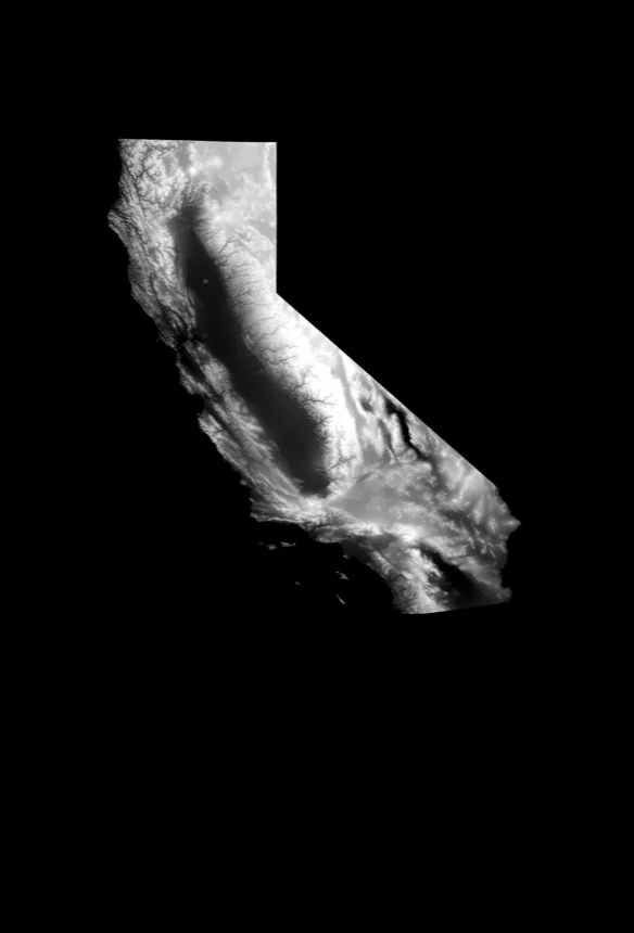
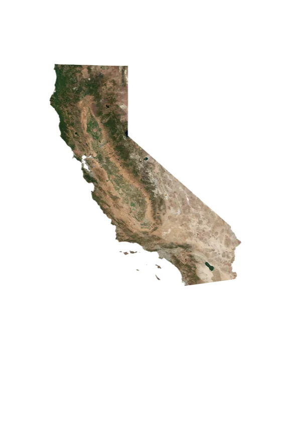
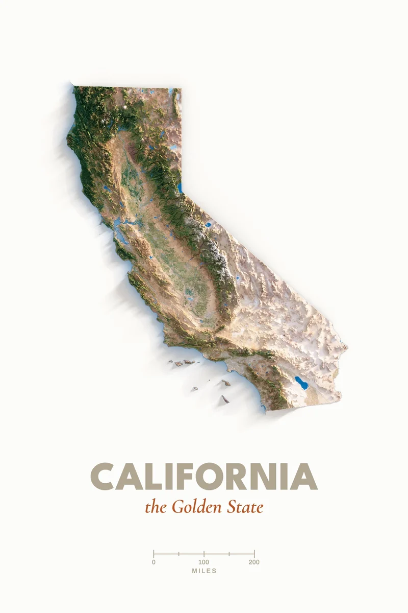
- The card you hold Far Maps render · print · emboss Our design
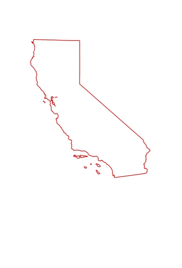
- Boundaries & coastline U.S. Census Bureau (TIGER) Public domain
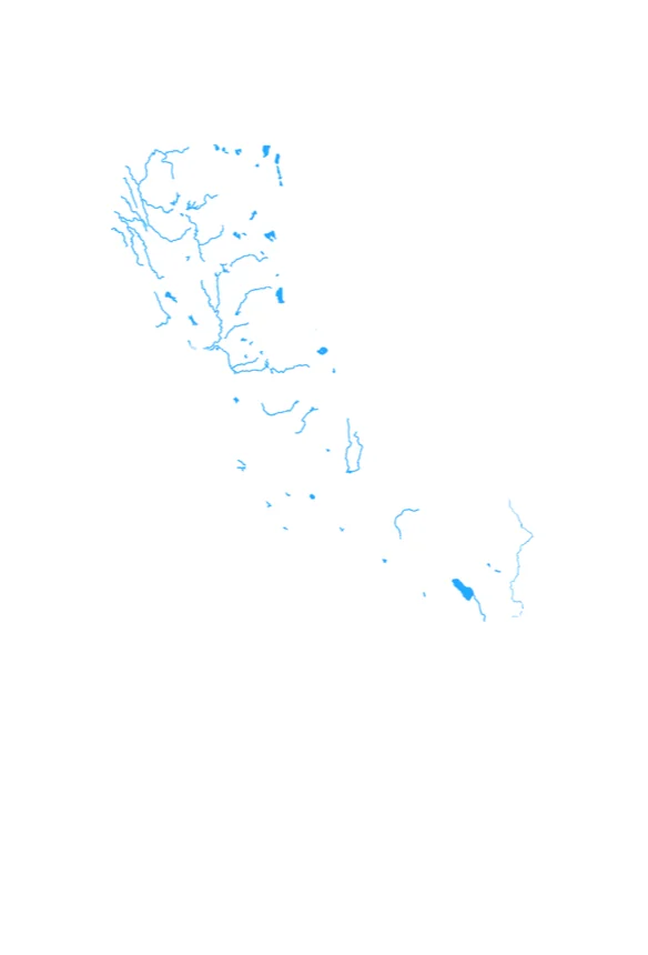
- Rivers & water USGS NHD · Esri Living Atlas CC BY 4.0
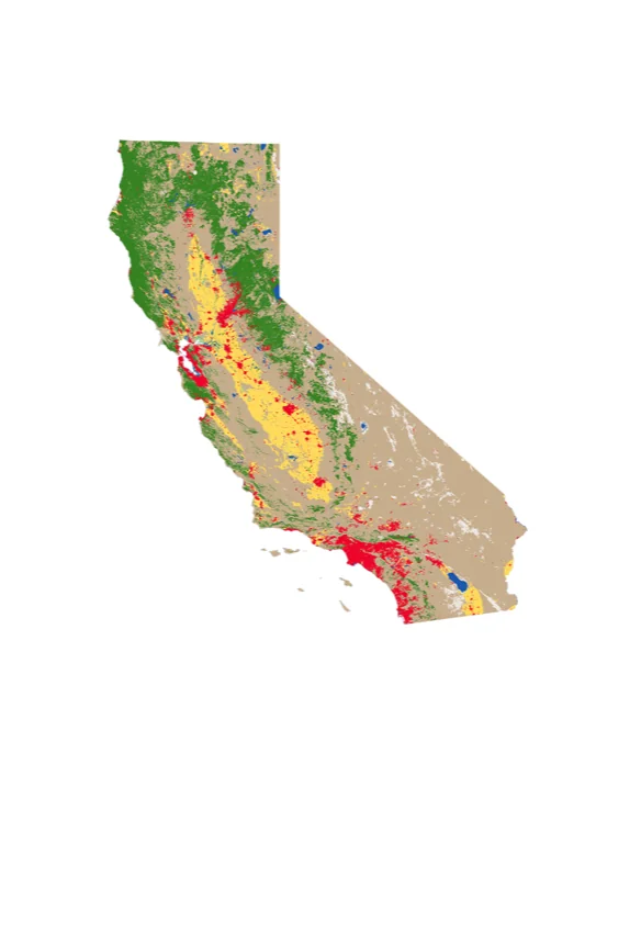
- Land cover Esri · Impact Observatory CC BY 4.0
- Satellite imagery Copernicus Sentinel-2 · NASA MODIS (USA card) Open data
- Elevation USGS 3DEP Public domain
- The card you holdFar Maps render · print · emboss Our design
- Boundaries & coastlineU.S. Census Bureau (TIGER) Public domain
- Rivers & waterUSGS NHD · Esri Living Atlas CC BY 4.0
- Land coverEsri · Impact Observatory CC BY 4.0
- Satellite imageryCopernicus Sentinel-2 · NASA MODIS (USA card) Open data
- ElevationUSGS 3DEP Public domain
Questions
What's confirmed. What's still being tested.
- Are these real raised cards?
- Yes. Everything photographed on this page is a physical production proof, made in July 2026. The shaded-relief image is printed first, then a metal die presses the terrain into the paper. The relief you feel is the card itself, not a printed illusion.
- Is the relief an exact scale model?
- No. The landforms are derived from real elevation data, but the vertical relief is adjusted so terrain differences remain visible and touchable at postcard size. We will not describe the cards as "true to scale."
- Which cards exist so far?
- Four: California, Colorado, Washington, and the United States card. They are printed, embossed and trimmed — real cards, not renderings — made to check terrain detail, ink, paper, embossing pressure, and feel. The other 47 states do not exist as finished cards yet.
- Why Kickstarter?
- Every design needs its own metal embossing die, cut before a single card can be printed. Forty-seven dies remain, and they are the largest single cost in this project. The campaign funds those dies, the remaining state designs, and the printing and embossing run.
- Can they be mailed as postcards?
- They are designed as 4 × 6 in postcards with a stamp area and writing space. Mailing tests are still underway; final paper, embossing depth, postage, and handling details will be confirmed before production.
- Is the campaign live now?
- Yes. The campaign is live on Kickstarter and closes October 22, 2026 at 10:00 AM ET (7:00 AM PT). It is all-or-nothing: your card is only charged if the project reaches its funding goal by then. Back it on Kickstarter, or get email updates.
- I joined the list. Where's the welcome email?
- A welcome email from hello@farmaps.earth goes out within a few minutes of signing up. We're a new sender, so it often lands in Spam or Gmail's Promotions tab — look there, mark it Not spam, and add us to your contacts so our updates get through. Still nothing? Write to us. You can also back the project on Kickstarter, where updates reach you independently of email.
The campaign is live
Back it on before October 22.
All-or-nothing: your card is only charged if the project reaches its goal.
Back this projectNot ready yet? Get production updates by email.